Backstrip help
Overview
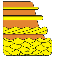
Backstripping is used to calculate the accommodation or relative sea-level change during the accumulation of a stratigraphic column. From this, inferences can be made about subsidence and uplift, as well as sea-level changes. Backstripping is accomplished by decompacting sediment progressively as layers of strata are removed, and by calculating the isostatic unloading of the lithosphere as those strata are removed.
Backstrip is free. If you use it for a published paper or talk, please list Backstrip in your references or mention it in the acknowledgements section. In either case, indicate that the program is available at this website or through the Mac App Store. Journals differ in citation format, but this is a sample citation with the primary information most journals will require:
Holland, S.M., 2021. Backstrip, version 1.1. www.huntmountainsoftware.com
How backstripping works
Backstrip uses the simple Airy (that is, not flexural) backstripping algorithm of Watts and Ryan (1976). Backstripping progressively removes stratigraphic units, decompacts the underlying stratigraphic units, and isostatically rebounds the lithosphere. From this, the amount of accommodation (that is, the sum of tectonic subsidence and sea-level rise) created during the accumulation of the stratigraphic column is calculated.
Compaction of sediment is described by the relationship:

where φ and φ0 are the final porosity and initial porosity, c is a compaction coefficient, and z is depth of burial. Following Angevine et al. (1990), Backstrip uses compaction coefficients of 3.0x10⁻⁴ for sandstone, 5.0x10⁻⁴ for shale, and 7.0x10⁻⁴ for limestone. Initial porosities are 0.4 for sandstone, 0.5 for shale, and 0.5 for limestone. Compaction is integrated over the thickness of each unit.
Preparing your data
Enter your stratigraphic column in the table in Backstrip, with one row for each stratigraphic unit. You can enter your column any way you like, with the oldest units at the top, at the bottom, or in no particular order. Backstrip will use the age column to order the units for the backstripping. As you enter units, you can change how they are sorted by clicking on the column headers (for example, the column heading “Age at end”).
Enter the name of the unit in the first column. Although this has no effect on the backstripping calculations, it makes the column file easier to read. Be sure to enter unconformities along with the stratigraphic units.
Every unit should be assigned a lithology (shale, sandstone, or limestone), which is used in decompaction calculations. Many stratigraphic units are lithologically heterogenous, so use the term that best fits. Remember that shale compacts much more than sandstone or limestone, so if a unit has a large amount of shale, it is best to use the shale lithology, as it will better capture the amount of compaction that has occurred. For unconformities, use the unconformity lithology.
Thicknesses and water depths use meters for their units. For water depths, positive values indicate marine units and negative values correspond to nonmarine (think of negative water depth as being meters above sea level). Because water depth is often one of the largest uncertainties in backstripping, include maximum and minimum values to create an uncertainty envelope around the backstripping curve. If you have no idea about water depths or elevations, you can leave all the values as zero. Even so, your backstripping curve will be more accurate if you include some estimate, even if the uncertainties are large.
The units of age are millions of years (e.g., entering 150 would mean 150 Ma). Although these values do not affect the backstripping calculations, they do affect how the units are ordered and they control how the data is plotted. Because these ages all reflect age at the end of the unit, be sure that the oldest unit in your column is an unconformity, with an age corresponding to the age at which deposition of the first unit began.
Interpreting your results
The accommodation estimates made by Backstrip are plotted against the ages of the units, with time moving towards the right. A downward trajectory indicates increasing accommodation, through subsidence or eustatic rise, with steeper slopes indicating faster rates of accommodation. An upward trajectory indicates a loss of accommodation, through uplift or eustatic fall.
The backstripping plot consists of a single line surrounded by a band of color. The line represents the accommodation estimate built from the best estimate of water depth, and the band reflects the accommodation curves built from the maximum and minimum estimates of water depth.
The plot can be saved as a pdf, which is also editable in apps like Adobe Illustrator. The results, along with the data that generated them, can be saved as a comma-delimited file, which can be read by word processors, spreadsheets, and data analysis apps like R. In this output file, the accommodation, accommodation max, and accommodation min columns correspond to those estimates made from the water depth, water depth max, and water depth min columns.
Recommended reading
Allen, P.A., and J.R. Allen. 2005. Basin Analysis: Principles and Applications. Blackwell: Malden, Massachusetts, 549 p. See p. 363 for an outline of the backstripping procedure.
Angevine, C.L., P.L. Heller, and C. Paola. 1990. Quantitative sedimentary basin modeling. American Association of Petroleum Geologists Continuing Education Course Notes 32, 133 p. Describes the backstripping algorithm.
Holland, S.M., and M.E. Patzkowsky. 1998. Sequence stratigraphy and relative sea-level history of the Middle and Upper Ordovician of the Nashville Dome, Tennessee. 68:684–699. Example of an application of backstripping.
Sahagian, D.L., and S.M. Holland. 1991. Eustatic sea-level curve based on a stable frame of reference. Geology 19:1209–1212. Example of an application of backstripping.
Steckler, M.S., F. Berthelot, N. Lyberis, and X. Le Pichon. 1988. Subsidence in the Gulf of Suez: implications for rifting and plate kinematics. Tectonophysics 153:249–270. Example of an application of backstripping.
Watts, A.B. 1988. Gravity anomalies, crustal structure and flexure of the lithosphere at the Baltimore Canyon Trough. Earth and Planetary Science Letters 89:221–238. Presents flexural backstripping, which is not done in Backstrip.
Watts, A.B., and W.B.F. Ryan. 1976. Flexure of the lithosphere and continental margin basins. Tectonophysics 36:25–44. Describes the backstripping algorithm.